Anyway, I started out from home and was supposed to meet up with Tom Lashbrook, a retired NPD motorguy, in Fernley, NV. but he was running late so I headed out on my own.
There is really not much to say about I-80 to all the way to Winnemucca. After you pass Reno, it is just sage brush, sand, cross-winds, and heat. Traffic was pretty light and with the 75mph speed limit you can really chew up some miles (which I did). In Winnemucca I hooked onto I-95 north out of Nevada and into Oregon.
The last stop for gas was in McDermitt, NV. Below is a picture of that sprawling metropolis:

At least it was a Shell Station, but not much of a market. I had planned on getting a deli-sandwich, but the deli was really a butcher shop. Didn't see any roast beef, turkey, chicken, or the regular deli fixins. But I did see some wild game in various stages of dis-assembly. I thought better of my lunch decision and headed north into Oregon.

Now Oregon is a different state to be sure. I-95 really does not change much in Oregon. It is still a two-lane highway that is in good shape. The landscape really does not change. The same hues of brown and tan exist as far as the eye can see. What is really strange is where Nevada feels that 70mph is a safe speed, Oregon feels that 55mph is a safe speed. It feels like you are crawling. One thing 55mph does allow you to do, is to enjoy the different fragrances of roadkill. As you enter the thicker, fragrant air it is fun to guess the species of roadkill before you pass it.
My next stop was lunch in Rome, Oregon. I am really not sure why the town was named Rome. It must have been named after a person, or someone who had a love affair with the City of Rome through books or stories they read or heard. There really is nothing 'noble' about the spot on the map.
Below is a picture of the only restaurant in town (hey, its AAA approved!):

After an okay hamburger, I continued north on my trek to Boise. It was about 1:30 pm and the temperature had been hovering around 90 for the last hour. About 1 mile past Rome, I spied a cow sleeping on side of the road. Must have been the victim of cow tipping. Well maybe it wasn't sleeping. All I know is that I had flashbacks of my deer encounter in Washington a few years ago. I survived that one, glad I didn't meet the cow on the road, it would have been a tie!
After the cow-encounter a couple of 'rabbits' passed me. Now, knowing how radar works with vehicle size and speed, I strategically placed myself in third position. These 'rabbits' were hovering around 75mph ( a much more reasonable speed) and took me into Idaho. Finally, a reasonable speed limit of 70mph!
I pulled into the hotel around 4:30p.m.. It was nice to get off the bike after 400+ miles in the saddle. The next three days were pretty uneventful. Went to a few Blue Knight gatherings and hung around for three days. The highlight was getting a new tire installed at Snake River Motorsports. A good place to get work done if ever you find yourself up this way. I did manage to find a good Mexican restaurant within walking distance.
Headed out early Wednesday morning on my way to Missoula, Montana. Headed up Hwy-55 through McCall, which sits next to Lake Payette. A nice little resort town with all the resort type of amenities (read traffic and tourists). I passed the 45th parallel, halfway between the equator and the north pole for the second time while on Hwy-55. After I cleared McCall and the Payette National Forest, I dropped down into Hells Canyon National Recreation Area. An aptly named area.
I drove through the town of Riggins where the green of the forests was replaced with dry, brown grassy hillsides. The temperature did not disappoint. I passed the local bank that had the required time and temperature sign that indicated a toasty 102 degrees.
Here's a couple of pictures of Hells Canyon:

And here is another way to enjoy Hells Canyon...

The strange thing about riding so close to the 'Mountain time' zone is crossing it several times during this trip. Just outside of Riggins I crossed back into Pacific time. My GPS and bike clock were finally correct! Just like that I gained an hour! My phone updates each time I cross a time zone, so I don't have to keep adding or subtracting an hour.
Once I mercifully cleared Hells Canyon, it was onto Hwy-12 which follows the Louis and Clark Trail. Hwy-12 also runs alongside the Lochsa River. I have ridden this road a couple of times before. It is always in good repair and not well traveled. It just beckons for a good, moderately paced ride.
Here is the sign that greets you onto Hwy-12:
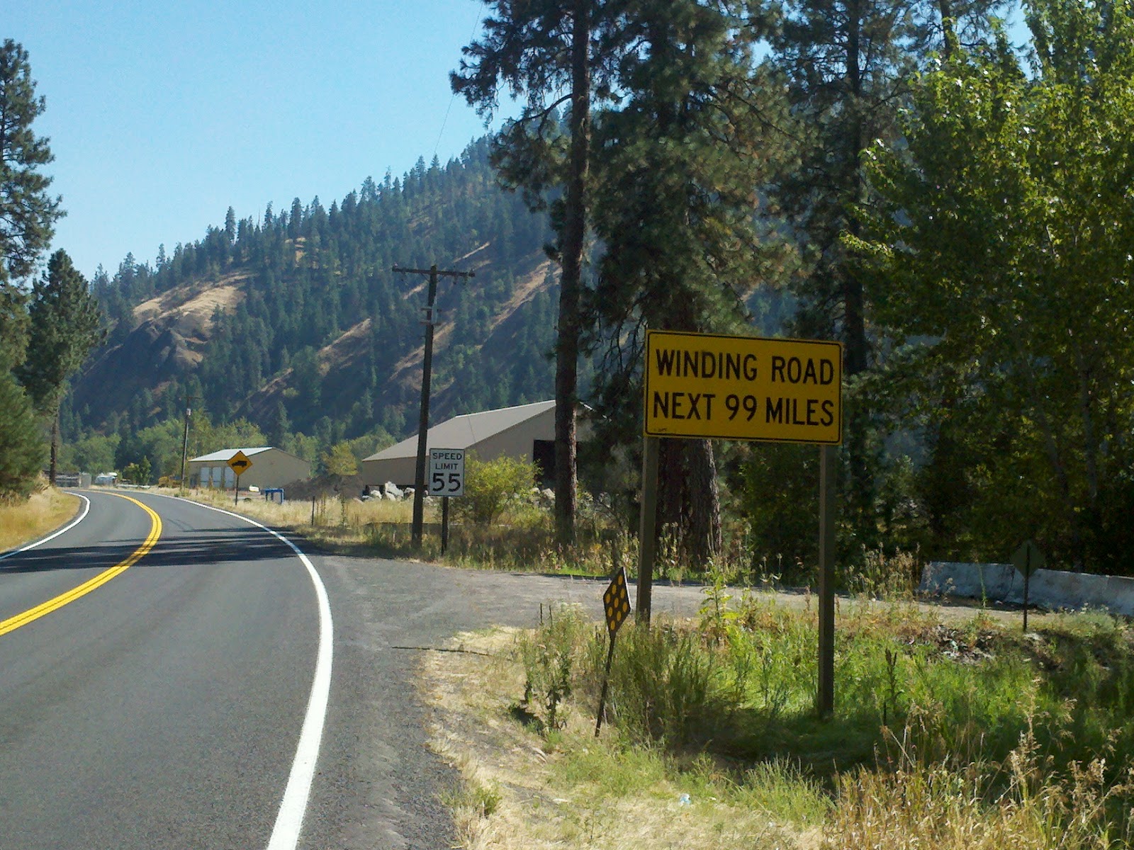
Having ridden this road before, I knew what to expect as I traversed this ride. That 55 mph sign was more like an 'advisory' speed limit. Hwy-12 crosses into Montana at Lolo Pass. The road tops out at 5235 ft. That big yellow sign in the background warns truckers of sharp curves for the next 4 miles.


Missoula lies at the bottom of what was once a lake. Because of that it is surrounded by steep hills. The surrounding terrain also gives Missoula its moniker of being the "Hub of Five Valleys" in reference to the five mountain ranges and valleys that converge in the valley: The Bitterroot Mountains, Sapphire Range, Garnet Range, Rattlesnake Mountains, and the Reservation Divide.
The next day I began a short trek to Eureka, Montana. It is about 8 miles south of the U.S./Canada border on Hwy-93. My route took me past Flathead Lake which is the largest freshwater lake in the western United States. It is a bit larger than Lake Tahoe. I stopped off in Polson, which is a little town on the shores of Flathead Lake. Here's a picture I took:

After Polson I continued north on Hwy-93 going as far as I could. Here is why I did not go further:
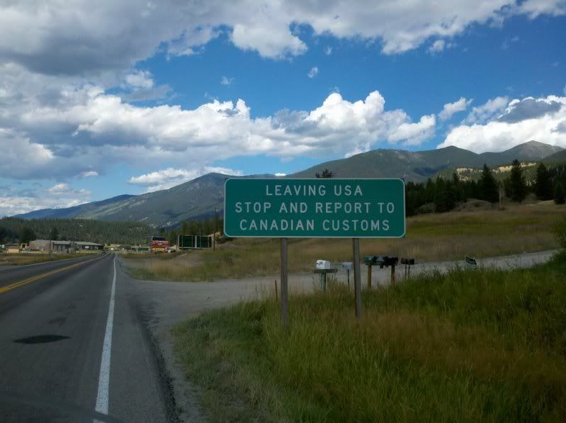
Since I did not have my passport with me I decided to check-in to the River Stone Family Lodge.
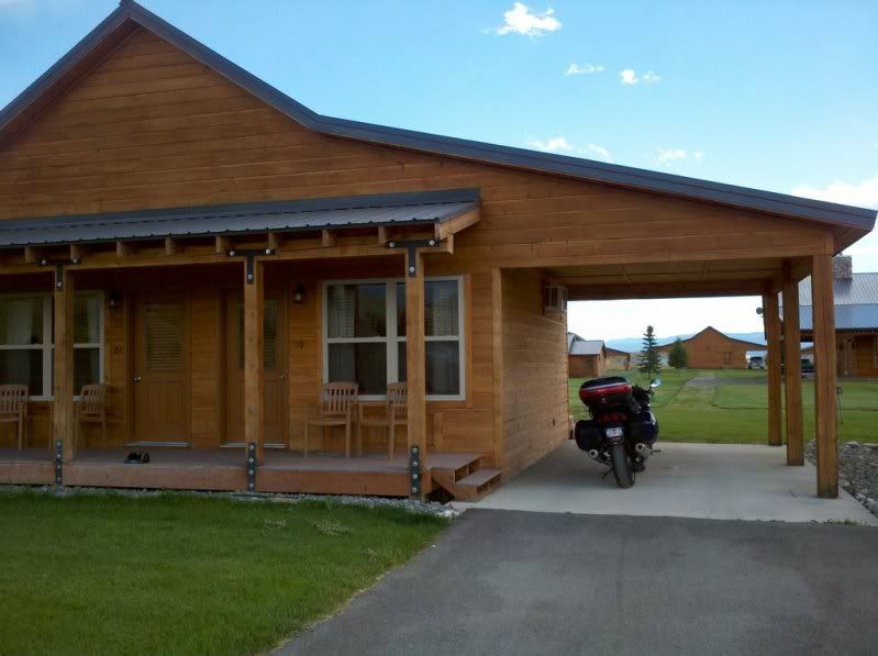
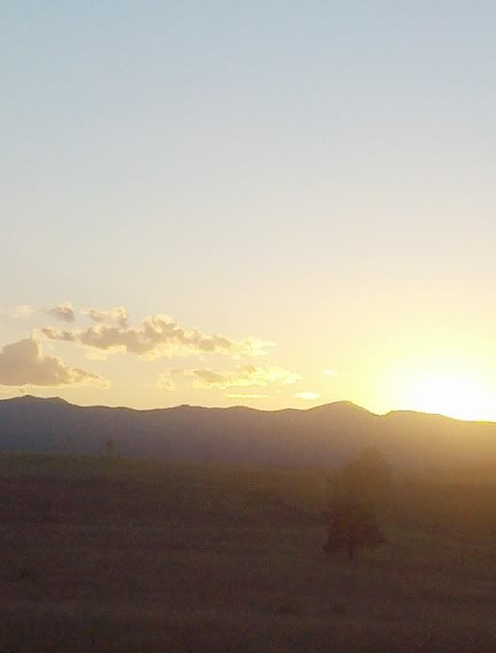
It was a neat little resort made up of about 10 duplex type cabins. Very rustic and nice accommodations. My 200 mile day ended with this view:
Day seven of my adventure was scheduled to end in Coeur d'Alene, Idaho. I planned on a round-about route along Hwy-37 that runs alongside Lake Koocanusa (really...thats the name). A little side note about Lake Koocanusa. It is really a reservoir that stretches 90 miles long. 48 miles of it are in Montana and the rest is in Canada. The name is a combination of the Kootenay River (that flows into it), Canada and the United States.
The reservoir is formed by the Libby Dam